Wednesday, February 24, 2010

New Books - Hot Off The Press!


Announcing two new history books compiled by Jackie Niemi, featuring oral history excerpts of homesteading on Beaver Creek.  The new titles are “And the Land Provides,” which describes some of the hardships and benefits of living off the land, and “The Perils of Pioneer Living,” which includes some gripping tales of life in the early days of the area.

Each book is designed on the computer and printed on a regular 8-1/2 x 11” sheet.  The page is cut in the center and folded in such a way to make a small eight-page book.

These are second & third in a series of six or eight small books planned about the history of Beaver Creek.  Each book sells for $5.00.  They are available in Newport at Canyon Way Bookstore and the Lincoln County Historical Society Museum Bookstore.  

Collect them all!

Posted by jackie.

Wetland Function and Value


The photo shows skunk cabbage which blooms in the marsh in Spring.  It is a typical wetland plant that grows in areas that are inundated through part of the year, usually in Winter and Spring.  Wetlands are identified using combinations of hydrology, vegetation, and soils.  These criteria are matched with regulatory definitions to delineate and map precise boundaries for wetlands.  Two primary standards are used presently; the U.S. Fish and Wildlife Service definition and the U.S Army Corps of Engineers definition.  States and local governments may also have specific definitions amended to the federal standards.  
Evaluating and understanding the functions and values of wetlands is important because no net loss of function or function and value are standards applied in federal, state, and local regulations.  Function and value are also important in planning, acquisition, and management of wetlands.  Evaluation of wetlands is usually made through analysis of four factors.  The 1st includes natural processes occurring within wetlands.  Examples include denitrification, biomass production, and flow retardation.  The 2nd factor includes offsite natural resources that are critical to wetland processes.  Examples include watershed hydrology, habitat connectivity, and presence or absence of buffers.  The 3rd factor is cultural context of wetlands in the watershed.  These may include roads, dams, houses, farms, and factories.  The 4th factor is the society attitudes towards the roles and outputs of wetlands.


Beaver Creek Marsh © Roy Lowe
Functions of wetlands match well with factors 1 and 2, while values match well with functions 3 and 4.  These factors can be evaluated by quantitative studies, surveys of public opinion, and consulting political will and legal statutes.  The functions and values may change over time and can be enhanced or degraded by changes occurring in the watershed and in social factors.  The dynamic nature of these functions and values makes analysis of wetlands for education and regulation difficult at best and subject to differences in opinion and political power.  A wetland in one community may be valued highly, while in another community, the same wetland may be viewed as having little or no value and as an obstacle to economic development. 
What are some of the functions and values of wetlands?  They can provide: flood storage and conveyance; erosion control; crops and timber; groundwater recharge and discharge; atmospheric gas exchange; micro-climate modification; habitat for fisheries and for other mammals, reptiles, amphibians, and endangered or threatened species; scenic beauty; recreation opportunities; historical, archaeological, and heritage value; and education and research opportunities.  Wetlands can reduce wave damage to shores and sediment loading in open bodies of water, and can prevent and treat pollution from upland areas.
Clearly some or all of these functions and values may have importance for different communities.  Since social structure varies among urban and rural settings and political persuasions, we can easily see the difficulty for objectively assessing the functions and values of wetlands.  Wetlands are rich in habitats, species, and connectivity and can be an important meeting ground for reconciliation of differences in opinion and philosophy and for understanding how society changes in an historical context.  The present use of Beaver Creek Marsh as a classroom and recreation area provides many opportunities to explore and research the genesis of natural systems, culture, and human viewpoints.  
Beaver Creek Marsh is a prime example for the effects of history on the changing interactions of society and wetlands.  Pre-history uses by humans were defined by harvesting of natural resources.  The development of farms and logging by early settlers attempted to enhance economic resources beyond simple hunter-gatherer activity.  Initially farmers sought to dredge, dike, and drain wetlands to increase pasture land.  As costs for farming increased, residents turned to day jobs in urban areas for income and later generations eventually became more willing to recognize the natural values of wetlands by granting conservation easements or sales of wetlands for economic gain.  As urban areas increased, more people turned to recreational opportunities available in the marsh.  Now the Beaver Creek State Natural Area is being developed by Oregon State Parks.  This Natural Area will be the Featured State Park in 2010 and many more people will come for recreation and to appreciate the natural beauty and values of Beaver Creek Marsh in the future.  The marsh and adjacent uplands and forest will be an incredible jewel and legacy in the future, conserving the natural functions of a rare coastal wetland and its watershed for generations to come.    
Posted by michael

Tuesday, February 23, 2010

Plum Blossoms Along A Branch

Plum blossoms appear in the sun along a branch.  An old Ch'an monk thinks that they are poetry, writes it down, and we nod our heads in agreement.  Soon enough they will be fruit and chipmunk will eat them.  She left one for me to taste last year.  Thankful for the sky tasting of plum when I looked up in the tree that day.
Posted by michael

Saturday, February 20, 2010

Pussy Willow Appears In The Marsh


One of the first books my dad read to me was ‘Pussy Willow’, a Little Golden Book by Margaret Wise Brown.  This is a story of a kitten who is full of wonder as Spring appears and named himself Pussy Willow because he looked like them.  He meets many creatures of the marsh, including bug, frog, mouse, wild strawberries, and green grasshoppers.  While on the journey, he lost pussy willows as Spring passed.  He searched high and low, night and day to find pussy willows.  He asked butterfly, nesting birds, bee, cabbage, mole, rabbit, skunk, and woodpecker if they knew where pussy willows were.  And each told Pussy Willow that pussy willows were to be found where they found their favorite things.  He further asked hermit crab and red squirrel.  He saw purple asters, golden rod, pearly everlasting, blueberries, blackberries, and raspberries.  But he still could not find pussy willows.  Summer passed, then Fall, followed by Winter.  Soon Groundhog woke him up and Spring came.  Redwing blackbird, meadowlark, and bobolink began to sing and spring peepers in the marsh began to peep.  He looked up and saw that he had fallen asleep under a willow that had burst into pussy willow bloom.  Pussy Willow purred ‘everything that anyone would ever look for is usually where they find it’.


Pussy Willow © 1951, 1979, Margaret Wise Brown

This story and its illustrations leave an indelible impression in my mind and remind me of the mystery of the marsh when I see pussy willows in bloom.
Posted by michael

Thursday, February 18, 2010

Seasonal Water Levels In The Marsh

There is a seasonal change in the average water level of Beaver Creek Marsh.  In the months between April and October, the water is lower in the marsh, while between November and March, the water is higher.  The seasonal average water level changes approximately 2 feet.  As water level changes, water moves into and out of the margins of the marsh and large areas are flooded or dried.  Zonation of plant species in the marsh depends in part upon this seasonal flooding and the relative tolerance of species to flooding.  

Monthly mean tidal heights (meters) relative to Mean Sea Level

Looking at the monthly mean tidal height in South Beach, which is 7 miles to the north, we can see the same seasonal cycle of average water levels that is evident in the marsh.  In November - March, sea level is above annual mean sea level (MSL).  In April - October, sea level is below MSL.  The change in monthly mean sea level over an annual cycle is approximately 1 foot.  While monthly mean sea level appears to control water level in the marsh, it does not explain the magnitude of change.  Monthly mean rainfall in South Beach follows the same pattern shown by tidal height, with higher rainfall in fall and winter months and lower rainfall in spring and summer months.  The additional rainfall input to the Beaver Creek watershed during the fall and winter probably accounts for the greater magnitude of water level rise in the marsh, beyond that associated with tide level.  


Monthly mean precipitation (inches) in South Beach, OR

This description is oversimplified since ocean beach sand levels and debris dams can contribute to varying water levels in the marsh, but their effects generally conform to the same seasonal cycle of higher and lower average water level.  Superimposed on the average seasonal cycle are the additional effects of daily cycles of tides, wave height, wind, and rainfall.  During the rainy season, these factors can push water back into the creek and marsh as rainfall puts water into the watershed.  During the dry season, effects of weather are minimal and slow draining of the water table generally lowers marsh levels.


Daily tidal height (feet) in South Beach, OR

Posted by michael     

Wednesday, February 17, 2010

Nature's Sculpture - Here Today, Gone Tomorrow


On a couple of recent walks through the marsh I caught these fleeting sculptures of tules and other marsh plants with their reflections.  Wind and rain have been beating down the spent vegetation all winter.  Their heads are submerged and stalks bent and creased by the forces of nature.  The shapes seem “afloat” in the flooded marsh, their reflected other half forming the whole.


These more delicate plants form “boat frames” reminiscent of the kind of frames I have made from willow wands as the basis for my salmon skin and paper-covered boat sculptures (for those of you who have seen my artwork over the years).
With spring stirring the mix, new green shoots of tule & cattail will soon rise out of these mounds of “dried” plant material, and red-winged blackbirds will be competing for nest sites within their sheltering thickets.      
Posted by jackie.

Tuesday, February 16, 2010

Signs Of Spring In The Valley


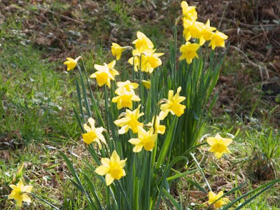
Daffodils are a welcome sight in the sun that came out today.  This time of year you can walk in the woods where old homesteads and farms were and see wide patches of daffodils that were planted by early settlers and continue to come up.

Snow drops are in full regalia now.


Crocus give a warm smile and lovely color.

Quince give the promise of ripe fruits for chipmunk in the summer.

Vinca is a stunning blue and hints of possible cures for cancer. 

Huckleberry flowers greet bees and promise ripe blue fruit for birds, chipmunk, bear, and even deer who sometimes choose to strip the bushes in late summer.

Oregon grape is bright and promises berries for birds and chipmunk.  The roots make good medicine for colds and flu.

Lungwort has bright blue flowers and is good for lung infections.

The red ants have even woken up.  Today they were basking in the sun, getting organized for the upcoming season of harvesting, feeding, nest building, and defending.  I met these ants on the land early on and we quickly made friends.  Soon after I bought the acreage, I moved a 1959 Marcy 37' trailer up on top of the hill and watched the seasons go by through four years to determine the best home building and gardening sites.  The trailer had beautiful wooden cabinets inside and was quite cozy, in spite of its age and the pack rats that moved into the walls occasionally.  However, there were carpenter ants in the framing behind the walls.  One day I came home to find a swarm of red ants in a front corner of the trailer.  I wondered what kind of trouble they would be since they bit pretty hard if you bothered them.  I waited to see what would happen.  Within a couple of days, there were black heads of carpenter ants falling from the ceiling and I realized that these red ants would do a good job of cleaning out the carpenter ants from the trailer.  After a couple of weeks the red ants seemed to be done with the job and they moved out of the trailer and established a nest nearby.  Through the years they have multiplied and created new nests in various spots as needed.  They cruise the perimeter of buildings on the land and continue to meet, greet, and eat carpenter ants and termites when encountered.  Clearly these red ants are the champion pest controllers for human buildings, without the need for pesticides.  We get along well and they do not bite when I am gardening near their nests or encountering them on the hard-packed trails that they create, having walked over them so many times.

Posted by michael

Sunday, February 14, 2010

Early Surveying And Mapping On Beaver Creek, Part 2

1882 GLO Survey Map


In a previous post an early GLO map (1882) of the lower Beaver Creek Marsh showed that the creek bed ran approximately in the position of the present County Road 602.  We assume that the GLO survey map was accurate. Lets look at some later maps to see if Beaver Creek changed its course.

ca. 1898-1904 Survey Plat Map

1916 Survey Plat Map
Survey plat maps from ca. 1898-1904 and 1916 show that a large increase in land ownership occurred and that lower Beaver Creek had not changed its course from 1882.  

1937 Beaver Lake Club Proposed Development Map

A 1937 map of the proposed development for the Beaver Lake Club shows a clearly altered course for lower Beaver Creek.  Apparently the creek bed was altered sometime between 1916 and 1937.  We are searching for map records and oral histories within this time to help identify when the change occurred and what the probable causes were.  

©1950 Metsker Maps


©1984 USGS Topographic Map

Interestingly in the 1937 map, Beaver Creek flows straight into the Pacific Ocean.  In the 1950 map, the mouth begins to curve and has meandered to a more northerly position.  The 1984 map shows even more pronounced bends in the creek mouth.  In recent years the creek has changed again towards a straighter path into the Pacific Ocean.  

 Posted by michael

Early Surveying And Mapping On Beaver Creek

GLO 1874 Survey

GLO 1874 Survey


The Beaver Creek Marsh and surrounding lands (Township 12S, Range 11W) were surveyed by the U.S. government General Land Office in 1874-1877 and again in 1882.  The survey in 1874 produced a map with limited detail of the area, declaring part of the marsh and lands east of it to be ‘Rough and mountainous. Unfit for settlement and therefore unsurveyed.’  The survey of 1882 produced a map showing greater detail of the marsh, trails for travel through the Beaver Creek area, and houses present in the area that was previously unsurveyed. 

GLO 1882 Survey
GLO 1882 Survey

Comparison of maps for the bed of Beaver Creek between the 1882 survey and modern Lincoln County Assessors Maps shows fairly close correspondence, except in the Township 12S, Range 11W, Section 19 maps.  There the creek bed in 1882 is shown where Beaver Creek Road is now.  Is this an actual difference in the creek bed or is it a result of inaccurate surveying?  We cannot resolve that question now.  However it is clear that a large marsh was present in this area in 1882.

Assessors Map

Assessors Map
Posted by michael

Thursday, February 11, 2010

1832 Incident On Beaver Creek, Part 2

In the blog post on February 1st, I began a summary of an article written by R. Scott Byram for the Oregon Historical Quarterly.  This is a continuation of the story of the killing of Hudson Bay fur trappers on Beaver Creek in 1832, and the consequences that occurred.  
Two men and one woman had established a winter camp at Beaver Creek Marsh in the winter of 1832, and had amassed a large quantity of furs without permission from local Native groups [see previous post].  The author of the article referenced three historic accounts of the incident, and related its aftereffects.  Previously mentioned was the attack by the people of the woman who escaped murder--an attack that wiped out a large number of Yaquina people.
There is some ambiguity about the identity of the three trappers, though they were likely  Hudson Bay Co. (HBC) employees Pierre Kakaraquiron and Thomas Canasawarette out of Fort Vancouver, under the leadership of Chief Factor John McLoughlin.  The woman’s identity was not known, though she is called Chinook (however this could simply mean that she spoke Chinook jargon).  McLoughlin’s correspondence and reports from the time describe the incident and retaliatory attacks on the Yaquina & Alsea people.
When word got back to HBC headquarters at Fort Vancouver, WA of the trappers’ deaths, John McLoughlin ordered a party under the command of Michel Laframboise to travel to the coast and retaliate.  This expedition was told by McLoughlin to attack the “first Killamook group” they came across.  It resulted in the death of six innocent people, the capture of women & children who were threatened and later released, and instructions to the remaining villagers to kill the murderers.  The villagers were threatened with total massacre if the murderers were not caught and executed.  “...McLoughlin’s intelligence informed him that two local Indian people involved in the initial killings were later killed by relatives of those slain by Laframboise’s party.”
The author talks about the different methods of dealing with conflicts--local Native groups had a well-established system of negotiation and appropriate punishments for wrongs committed by community members.  The HBC methods were to use violence to protect their interests, and to intimidate and maintain control over the Native people they encountered, which often ended in killing.   
Corporal Royal Bensell, who was traveling down the coast with a detachment of Company D, Fourth California Infantry in 1864, gave this report of camping on the Alsea in April of that year.  (Company D assisted in transporting area Natives to the Reservation at Siletz).  They camped near the mouth of the Alsea on the south side, and described it as an “old Indian graveyard.”
“He wrote that the place ‘is where years ago the “Sixes” fought the Hudson Bay Co., lost some 400 warriors.  They are buried in canoes, the prow raised two or three feet in order to give the dead a good start heaven ward.’ ”  
“Notably, the name Bensell gave for the tribe, “Sixes,” sounds much like the word for ‘friends‘ in Chinook Jargon, sikhs.  If his sources were Alsea, they could have been referring to the Yaquina people.  Bensell or his translator likely mistook this word for the name of a south coast tribe near Cape Blanco.” 
Though we will never know exactly what happened all those years ago, Byram’s analysis points to events that greatly reduced the numbers of the Yaquina and Alsea people prior to the beginning of the reservation period in 1855.  Conditions on the reservation further decimated their populations from starvation and sickness.  Only a small number survived all these hardships, and their descendants are among the Confederated Tribes of Siletz today.  
Posted by jackie.  

Wednesday, February 10, 2010

Algae And The Microscopic World


One of the first signs of spring in the marsh is commonly referred to as pond scum.  With this naming, the fuzzy green stuff in the water is generally dismissed as yucky, stinky, and not worthy of further consideration.  But I took the path not so well travelled.  Years ago I got my first microscope and was hooked by the microscopic world.  I would spend hours looking at pond scum and imagining how it was to live in the science fiction world of aquatic plants and animals.  Later, I was introduced to a book, ‘Algae In Water Supplies: An Illustrated Manual On The Identification, Significance, And Control Of Algae In Water Supplies‘ which expanded the possibilities for me with a series of iconic illustrations that I have included in this post.


The artistic merit of microscopic algae is not to be denied.  They have rainbows of colors and shapes that stimulate the imagination.  Some algae (diatoms) build glass houses that look like transparent space ships and truly are fully provisioned boats that passively course through the waters of the world, feeding a multitude of animals that live in aquatic spaces.   


When studied in a scientific manner, algae unfold many secrets about history, habitats, plant biology, and food.  You can reconstruct the history of a wetland by analyzing the taxonomic structure of algal remains in cores of basin sediment beneath the water surface.  As conditions change in the marsh, pond, or lake, different algal species colonize the area and leave their remains after death in a chronological order of depth.  Reading the sediment core is like reading and writing a book and constructing a map of physical, chemical, and biological changes in the ecosystem.


Microscopic algae are important in so many ways.  They absorb CO2, pollutants, and plant nutrients to act as purifiers of water.  They supply O2 and food for animals and fungi.  They produce oil that can be harvested and used for fuel to run machines and heat homes and businesses.  Diatomaceous earth (remains of diatoms) is used as a medium in filters to produce clean water.  Microscopic algae can create nuisance for humans and animals by adding foul taste to water and plugging water filters.  Some species of blue-green algae are poisonous and act as neurotoxins when ingested.


So the next time you see pond scum, take another look and think about how these tiny organisms are part of your world.  With the unaided eye, we can only see a small portion of the world size spectrum.  The microscope and libraries expand this portion.  There are so many things going on without our conscious knowledge.   Expanding our knowledge helps to stimulate imagination and playful participation in the dance of life beginning to move with the first signs of spring.


Posted by michael

Sunday, February 7, 2010

All Tied Up By Spiders


This morning was one of those that has a dense fog in the valley before dawn.  When the sun rises the fog begins to lift and there is bright sun shining at a low angle.  You can see the individual fog droplets rising in the air as buoyant balloons of water filled with rainbow sheen as the sunlight passes through them.  All around in the bushes and fences are spider webs with the same rainbow sheen.  Everything is tied up by the spiders in the night and the morning looks like a package with ribbons of silk.  These times I can see that there are so many spiders everywhere.  It is amazing to see that they have strung webbing between distant branches and fencing and throughout the field.  They must have been flying through the air.  


Posted by michael

Thursday, February 4, 2010

The Topography Of Time


Source: The Agile Rabbit Book of Historical and Curious Maps 
by Pepin van Roojen © 2005

Maps are frequently used as metaphor.  They are useful tools for finding our way, in the literal and symbolic senses.  Maps tell as much about the perspective of the mapmaker as the land charted, by the information revealed.  As Peter Turchi says in his book, Maps of the Imagination: The Writer as Cartographer, “To ask for a map is to say, ‘Tell me a story.’ “
I’ve been thinking about layers of time.  The recorded history of Beaver Creek is a mere blink of the eye in the greater scheme of things.  Most written source documents occurred within the last 150 years.  Yet the evidence of those and earlier stories can still be found in languages that use other kinds of marks than the alphabet I am used to, leave other kinds of traces, if I only could translate them.  The stories I know about a place affect how I look at the landscape.  
I found that when the moment was right, by concentrating on some external object, an arrowhead...for example,...I was able to perceive something more than a simple mental picture of what some past event was like.  I not only could see the event or the place in my mind’s eye, but would also hear it, smell the woodfires; and sometimes, for just a flash...I would actually be there, or so it seemed. 
             -----John Hanson Mitchell, Ceremonial Time: Fifteen Thousand Years on One Square Mile (1984)
In a sense all time is happening all the time.  Bits of these strata bleed through to other eras.  They are evident in the geologic events that formed the shape of the land (the carving effects of glaciers, shell fossils of former sea beds, obsidian of past volcanic eruptions, for example).  Here on the Central Oregon Coast, buried and preserved tree trunks have been discovered that are revealed and covered by ever moving beach sand.  They point to where the forest edge once was.  Plant and soil analysis tells how long the land has been wet.
In more recent history, there are still remnants of pioneer-era fence posts at the edges of the marsh, where the waters were drained out enough to allow pasture land for farm animals.  A line of small conifer trees and shrubs across one edge of the marsh delineates the site of a railroad trestle used in logging.  Charred snags from historic wildfires transformed into nurse trees sprouting new seedlings.  Traces of past reconstituted into the forms we see today.  
“Maps are a way of organizing wonder.”  
     -----Peter Steinhart, “Names on a Map” (1986)
Posted by jackie.

Deer And Gardens


Yearling checking out the quince behind a fence

While making gardens on our land, deer have had much to say about the snacks that we provide.  Sometimes it seems as though we buy, plant, and nurture gardens simply for the enjoyment of visiting deer.  But then rabbits, chipmunks, raccoons, and birds get into the act and remind us that there are many mouths to feed here.  

But I am getting ahead of the story.  We live on a knoll that juts into the marsh.  At the base of the hill, 20 feet above the marsh, is an old log landing, a place where logs were last yarded in the mid 60’s to be trucked off to a mill.  This area is a level site with sunlight for a garden.  Initially I cleared the land of small alder trees and had a well driller come in.  We found water at 40 foot depth and established a well.  Then I began digging in the dirt to make a garden.  The soil was 3 to 9 inches of matted grass roots on top of hard grey clay.  While the grey clay looked to be of good quality for pottery,  I was quickly convinced that a garden would not flourish in this and built raised beds with cedar boards and top soil scraped off of an active quarry site.  Top soil does not imply that it had much fertility, just that it was not compacted clay.  After five years of adding mulch, compost, manure tea, and lime, we had soil that would support a flourishing garden.  We grew cold weather vegetables; lettuce, peas, beans, carrots, chard, kale, and beets.  While the temperature warms to the 60’s during summer days, it falls into the 40’s during the nights and there is a cool breeze that flows down the Beaver Creek valley from the Coast Range.  Growing popular warm crops - tomatoes, peppers, squash, and eggplant is not possible because they do not ripen.  We could have built a greenhouse, but the thought of how much mold would result was not inviting.  We did manage to grow corn a couple of years, but about that time the animals changed our minds about vegetables.

I knew that deer would be a problem for the garden.  There have been many proposed methods for repelling deer.  None of them work very well or with dependability.  Many people get a dog or two and this can work if the dogs are active, but some dogs are not interested in chasing deer, and the ones that are can be a real nuisance to wildlife.  We encourage wildlife on our land and do not have pets, so dogs and cats are not an option.  Fences can work, but deer can jump over a 12 foot high fence.  If you watch deer jump a fence, you will see that they run along side it and jump over.  They do not approach it head on and jump.  Knowing this, I built a 6 foot high fence and extended arms out at an angle from the fence posts to make a ‘gulag fence’.  I strung white clothes line along the arms, parallel with the fence line as something for the deer to see.  In this way, deer were inhibited from running along the fence and jumping into the garden.  We have not had deer in the garden in over 20 years, except the time I left the gate open and one walked in briefly. 
Winter view

Summer view

We also have flower, shrub, and herb beds throughout our land.  Jackie got the idea to fence them locally with 4 foot high fence that formed smaller beds into which deer would not jump.  I put up 800 feet of fence for this purpose and we have a large variety of flowers, herbs, and shrubs that supply us and wildlife with enjoyment, food, and medicine.  


Rabbits, chipmunks, and raccoons are another story.  For several years they were content to nibble around the edges and in the flower beds outside the vegetable garden.  Then slowly the populations built up and we shared more and more of the garden.  So I got tired of growing vegetables for the wildlife and switched the garden to red raspberries, blueberries, gooseberries, apples, and plums.  We still share with the wildlife, but I don’t have to work so hard with the perennials.  Some years, birds get into the act too and love the blueberries.  In the fall, black bear climb over the garden fence and into the apple trees if we don’t get the fruit first.  I like the black bears because they dig up ground wasp nests and save me the trouble of finding the nests by accident and getting stung.  All in all we have a close relationship with the wildlife who visit and live here and are happy to supply them with food and shelter when it suites them.
Posted by michael